What To expect when Hurricane Idalia hits Florida on Wednesday? Millions of people in Florida took care of their boats and homes and moved to higher ground on Wednesday as Idalia grew into a “extremely dangerous” Category 4 storm and threatened to hit the state’s Big Bend region directly.
As of late Tuesday, 28 of Florida’s 67 counties were telling people to leave. Storm watches or advisories are in effect for most of the state as well as parts of Georgia and South Carolina.
Here are the most important things you should know about how Idalia is expected to affect the world.
Contents
- 1 WHAT WILL THE PATH OF HURRICANE IDALIA BE?
- 2 How Climate Change Is fueling Hurricanes? Updated 2023
- 3 Category 3 Hurricane Idalia threatens to hit Florida as an even stronger storm in the coming hours
- 4 WHAT DO THE WORDS “STORM SURGES” AND “KING TIDE” MEAN?
- 5 ZONES FOR EVACUATION
- 6 WHAT kind of trouble could it cause?
WHAT WILL THE PATH OF HURRICANE IDALIA BE?
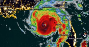
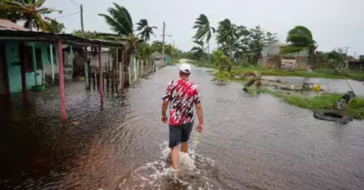
Idalia went from being a tropical storm to a Category 4 hurricane on its way to Florida early Wednesday morning. It had already caused flooding in western Cuba, forcing people in coastal towns to move to higher ground.
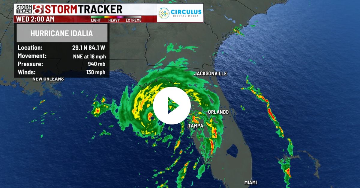
As of 5 a.m. EDT (0900 GMT) on Wednesday, Idalia was moving toward land 60 miles (95 km) west of Cedar Key, Florida, with winds of up to 130 miles per hour (215 kph).
In the past seven years, Florida has been hit by three big hurricanes: Irma in 2017, Michael in 2018, and Ian last September.
The NHC predicted that Idalia’s center will cross Florida’s coast somewhere in the Big Bend area, which is where the northern tip of the state’s peninsula meets the Gulf side.
-
How Climate Change Is fueling Hurricanes? Updated 2023
-
Category 3 Hurricane Idalia threatens to hit Florida as an even stronger storm in the coming hours
WHAT DO THE WORDS “STORM SURGES” AND “KING TIDE” MEAN?
Authorities say that the most dangerous thing about Idalia is a wall of water 10 to 15 feet (3 to 4.6 m) high that could flood low-lying places along Florida’s coast.
“Storm surges” happen when a hurricane’s high winds and pressure in the air push ocean water onto land. It might take a couple of days for the resulting floods to go down.
On Wednesday, there will also be a “king tide,” which is the highest type of high tide and is caused by the extra pull of gravity that happens when the sun and moon line up with Earth. This will likely make the waves from Idalia worse.
As Idalia gets closer, there are storm surge warnings for hundreds of miles of Florida’s coast, from Apalachicola Bay in the panhandle to Tampa, the state’s third-largest city, and all the way down to Sarasota in the south.
ZONES FOR EVACUATION
Authorities are working hard to get thousands of people in Florida out of harm’s way before it gets dark.
The Florida Emergency Management Agency said that people should leave 28 areas.
Some people had to leave their homes in 16 counties, especially those who lived near the coast or in places that were likely to flood or in mobile homes, RVs, or homes that were not built well.
Local officials opened dozens of shelters for people who had to leave their homes. They told people to pay attention to the directions to leave their homes. In a Facebook post, the sheriff’s office of Citrus County, north of Tampa, said,
“Please don’t get too comfortable. If you haven’t already, do something now if you haven’t already.”
WHAT kind of trouble could it cause?
Even Floridians who aren’t told to leave should expect problems because of Idalia, like power cuts and schools and businesses closing. 46 of Florida’s 67 counties are now in a state of emergency, which was announced by Governor Ron DeSantis. About 5,500 members of the National Guard were called up, and 30,000 to 40,000 people who work with electricity were ready to help quickly restore power after the storm passes.
Starting Monday afternoon, schools in the area stopped having classes. The Tampa International Airport stopped doing business and didn’t plan to start up again until Thursday.
Stay tuned to our website Usacharged.com for more updates.