
Geomorphology can play a crucial role in identifying and revealing fault slip, even in areas where there are no obvious surface signs of creeping. Here are some ways in which geomorphology can be instrumental in this process:
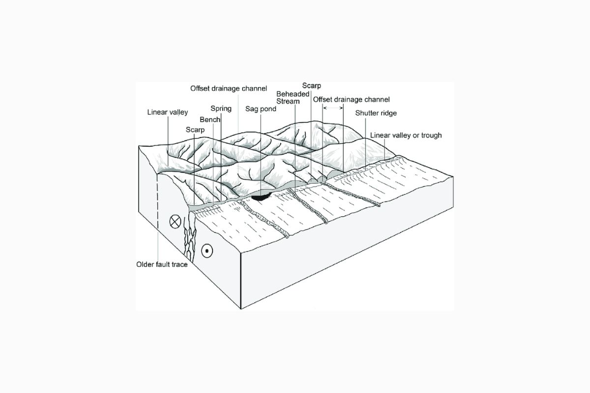
- Landscape Analysis: Geomorphologists study the shape, form, and evolution of landforms. They can analyze the landscape to identify features that may indicate fault activity, such as fault scarps, offset drainage channels, and fault-controlled topography. Even if there is no current surface rupture, these landforms can provide evidence of past fault movement.
- Offset Features: Geomorphologists examine features like river channels, ridges, and alluvial fans for offsets. When a fault moves, it can offset these features over time. By measuring these offsets, researchers can estimate the amount of fault slip that has occurred.
- LiDAR and Remote Sensing: Light Detection and Ranging (LiDAR) and other remote sensing technologies can provide high-resolution topographic data. Geomorphologists use LiDAR data to identify subtle changes in the landscape that may indicate fault slip, even in areas with dense vegetation or urban development.
- Historical Records: Geomorphologists often consult historical records, including maps, aerial photographs, and written accounts, to track changes in the landscape over time. These records can reveal evidence of fault activity that may not be immediately apparent on the ground.
- Geophysical Surveys: Geophysical techniques, such as ground-penetrating radar (GPR) and seismic surveys, can help identify subsurface fault structures and deformation patterns that may not be visible at the surface.
- Numerical Modeling: Geomorphologists and geophysicists often use numerical modeling to simulate fault behavior and its impact on the landscape. These models can help predict how a fault might interact with the surrounding terrain and what surface features to look for.
- Soil and Sediment Analysis: The study of soil and sediment deposits can reveal evidence of fault activity. Faults can disrupt the layers of soil and sediment, leaving distinctive patterns that can be analyzed to determine the timing and extent of slip.
In summary, geomorphology combines field observations, geological analysis, and modern technology to uncover evidence of fault slip, even in areas where there are no obvious surface signs of fault movement. This multidisciplinary approach is essential for understanding earthquake hazards and assessing the potential risks associated with fault activity.
Read More:


